 collaborative
mapping framework
collaborative
mapping framework
Simple participatory maps
collaborative
mapping frameworkSimple participatory maps
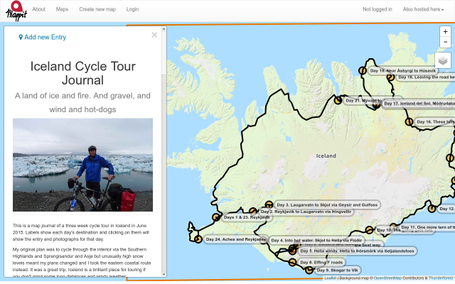
Mappit lets anyone create maps that others can contribute their views and knowledge to. Users can draw their own points of interest on maps or discuss things that others have mapped. It can be used for consultation & public participation projects, breaking news, travel journals, or for easily sharing niche interests that have a geospatial component.
Fast and simple. Create new maps almost instantly and start using them right away. At a minimum, you need only provide a title, description and geographic extent for your map.
Everything is managed online and maps are hosted at friendly-looking urls like this: mappit.net/layers/your-map-name.
You can moderate the content submitted to your map. You can edit or delete entries and comments, control where your participants can draw new features and suspend new submissions to the map at the end of the consultation (or allow it to continue indefinitely). The points of interest submitted to your map can either be viewable by everybody or they can be private so that prior submissions can't influence participants (useful for some surveys).
With zero cost and minimal setup, any hobby, niche interest or project can have its own map. From sightings of a specific bird species to angling marks, buried treasure in Staffordshire to wild swimming on Skye. Engage with others who share your passion and put your hobby on the map.
Maps can be embedded elsewhere on the web with a single line of code to help you reach a larger audience.